LocationCon 2017
Download my slides from LocationCon in Oakland, CA 5/24/2017 at the link below. Workflow and Design of an Emergency Flood Response Mapbook [360MB] More content to come…
NACIS 2016

Here’s the video of the presentation with slide/content from my original post below. Thanks to NACIS and the PCD coordinators for recording & processing the video and facilitating all the presentations. I presented a workflow using ArcMap, Illustrator, Photoshop, and InDesign this year at NACIS. Below is each slide image and video I used in my […]
Ohio GIS Cartography Workshop

I conducted a cartography workshop at the 2013 Ohio GIS Conference. If you attended the conference and would like to download the workshop materials hit the link below to download a zip file with everything you’ll need. Unzip the contents to your desktop and you are good to go. To get started, navigate to the 02_Exercises […]
Integrate Symbol and Label

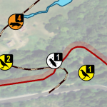
This technique saves some space and brings a refined look to the symbology in your maps. Integrating a feature’s label into its symbol makes for a professional style that should impress your client. Begin by building a symbol that will accommodate a label. In this case, I have a single digit number, which is basically […]
A Multivariate Line Style

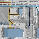
Wanted to share some symbology I developed for an electric utilities map recently. There were multiple variables to portray over aerial imagery. The first thing I did for this map was to adjust the imagery to black and white and tone down the contrast to really let the lines pop, then I started working on […]


