LocationCon 2017
Download my slides from LocationCon in Oakland, CA 5/24/2017 at the link below. Workflow and Design of an Emergency Flood Response Mapbook [360MB] More content to come…
Export MXDs in all subdirectories

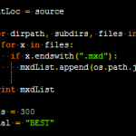
This is an answer to the question in my post on batch exporting mxd’s in a folder. James asked about exporting all mxds in all subdirectories of a root folder. Thanks James for distracting me from my work this afternoon to solve this :). Below is the code to accomplish this. The first loop populates […]
Calculating index rotation angle

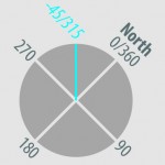
You’ve built your index layer and it might look something like this. If you’ve rotated these features manually and want to used them to control page rotation in data driven pages, you’ll need a field containing the page rotation value. This layer already has an angle field that I’m going to use to demonstrate how […]
2 (or more) maps, 1 mxd

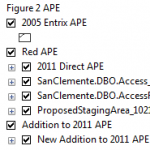
This is a production technique I use to create multiple maps in one mxd utilizing data driven pages. The cool part about this is that I’m creating truly different maps here, not a series of the same map in different places. The first step is to create an index layer that controls the map title, […]
Ohio GIS Cartography Workshop

I conducted a cartography workshop at the 2013 Ohio GIS Conference. If you attended the conference and would like to download the workshop materials hit the link below to download a zip file with everything you’ll need. Unzip the contents to your desktop and you are good to go. To get started, navigate to the 02_Exercises […]


