I make a lot of national and regional level summary maps. I incorporate bathymetry in these maps to add subtle detail and dimension. I’ll show you how to grab the data you need and provide the style and layer files for you to incorporate bathymetry in your maps.
 First head over to Natural Earth and visit the 1:10m Physical Vector Download page and download all bathymetry files, or you can just click here to download. Extract the shapefiles and note the directory where you’ve saved the data.
Next grab this layer file, NE_bathymetry.lyr. Save it in the same directory you’ve saved the bathymetry shapefiles.
Also download this style file, NE_bathymetry.style. For organization’s sake, put it in the same folder you’ve put all the other downloads so far.
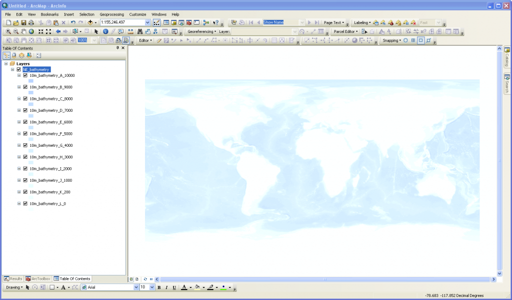
Now open a new ArcMap session and add the lyr file. Hopefully you’ll see something like this.
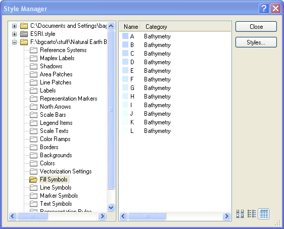
 Feel free to adjust the colors as you please. I’ve provided the style file in case you have a central symbology repository. The style file is just an extra that might make life a little easier if you do use style files in your workflow. Just a reminder, to see the style file contents go to Customize > Style Manager, then hit the Styles... button and hit add. Navigate to the style file you downloaded above and take a look at the contents. You can copy and paste the fill symbols into your own central symbology style. Hopefully this makes your life easier and your cartography better and more efficient.
 Tip
If you don’t use Natural Earth land data, the edges of the bathymetry may not line up perfectly with your land data. One way to create the illusion of a nice edge match is to change the data frame background color to match the fill color of the L level bathymetry layer. Another option is to create your own data to fill that gap by doing some geoprocessing on the bathymetry and your own land data to create data fills the gap.
Data Source
Thanks to awesome people at Natural Earth who put this data together and made it publically available, check out all the other data available as well. Please cite Natural Earth if you use the data.

 First head over to Natural Earth and visit the 1:10m Physical Vector Download page and download all bathymetry files, or you can just click here to download. Extract the shapefiles and note the directory where you’ve saved the data.
Next grab this layer file, NE_bathymetry.lyr. Save it in the same directory you’ve saved the bathymetry shapefiles.
Also download this style file, NE_bathymetry.style. For organization’s sake, put it in the same folder you’ve put all the other downloads so far.
Now open a new ArcMap session and add the lyr file. Hopefully you’ll see something like this.
 Feel free to adjust the colors as you please. I’ve provided the style file in case you have a central symbology repository. The style file is just an extra that might make life a little easier if you do use style files in your workflow. Just a reminder, to see the style file contents go to Customize > Style Manager, then hit the Styles... button and hit add. Navigate to the style file you downloaded above and take a look at the contents. You can copy and paste the fill symbols into your own central symbology style. Hopefully this makes your life easier and your cartography better and more efficient.
 Tip
If you don’t use Natural Earth land data, the edges of the bathymetry may not line up perfectly with your land data. One way to create the illusion of a nice edge match is to change the data frame background color to match the fill color of the L level bathymetry layer. Another option is to create your own data to fill that gap by doing some geoprocessing on the bathymetry and your own land data to create data fills the gap.
Data Source
Thanks to awesome people at Natural Earth who put this data together and made it publically available, check out all the other data available as well. Please cite Natural Earth if you use the data.

