Calculating index rotation angle

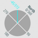
You’ve built your index layer and it might look something like this. If you’ve rotated these features manually and want to used them to control page rotation in data driven pages, you’ll need a field containing the page rotation value. This layer already has an angle field that I’m going to use to demonstrate how […]
SQL definition query list
Here’s a quick one, I see a lot of sql expressions written like this: Name = “Roosevelt” OR Name = “Jackson” OR Name = “Jefferson” OR Name = “Lincoln” OR Name = “Franklin” OR Name = “Washington” This can be written using the IN function. This is a little more legible and easier to compose […]
MOD function for contours

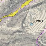
Say you have 1’ or 5’ contours with an elevation field. Instead of calculating a new field or making selections, you can use the mod function. I find it extremely useful. In the definition query tab of your layer properties: mod(“Contour”,25)=0 The mod expression above divides the Contour value by 25 and throws out any […]
How to quickly see who’s locking your geodatabase (gdb)
Working in a team can cause some extra issues to arise that you don’t come across when working alone. I wanted to share this because I need to know how’s locking me out of editing my geodatabase constantly, I find it useful, and it’s not super obvious. 1. Navigate to gdb in windows explorer 2. […]
Integrate Symbol and Label

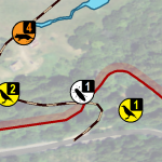
This technique saves some space and brings a refined look to the symbology in your maps. Integrating a feature’s label into its symbol makes for a professional style that should impress your client. Begin by building a symbol that will accommodate a label. In this case, I have a single digit number, which is basically […]


